
21. TELEGRAPH MAPS 1852 - 1868
Great Britain 1852
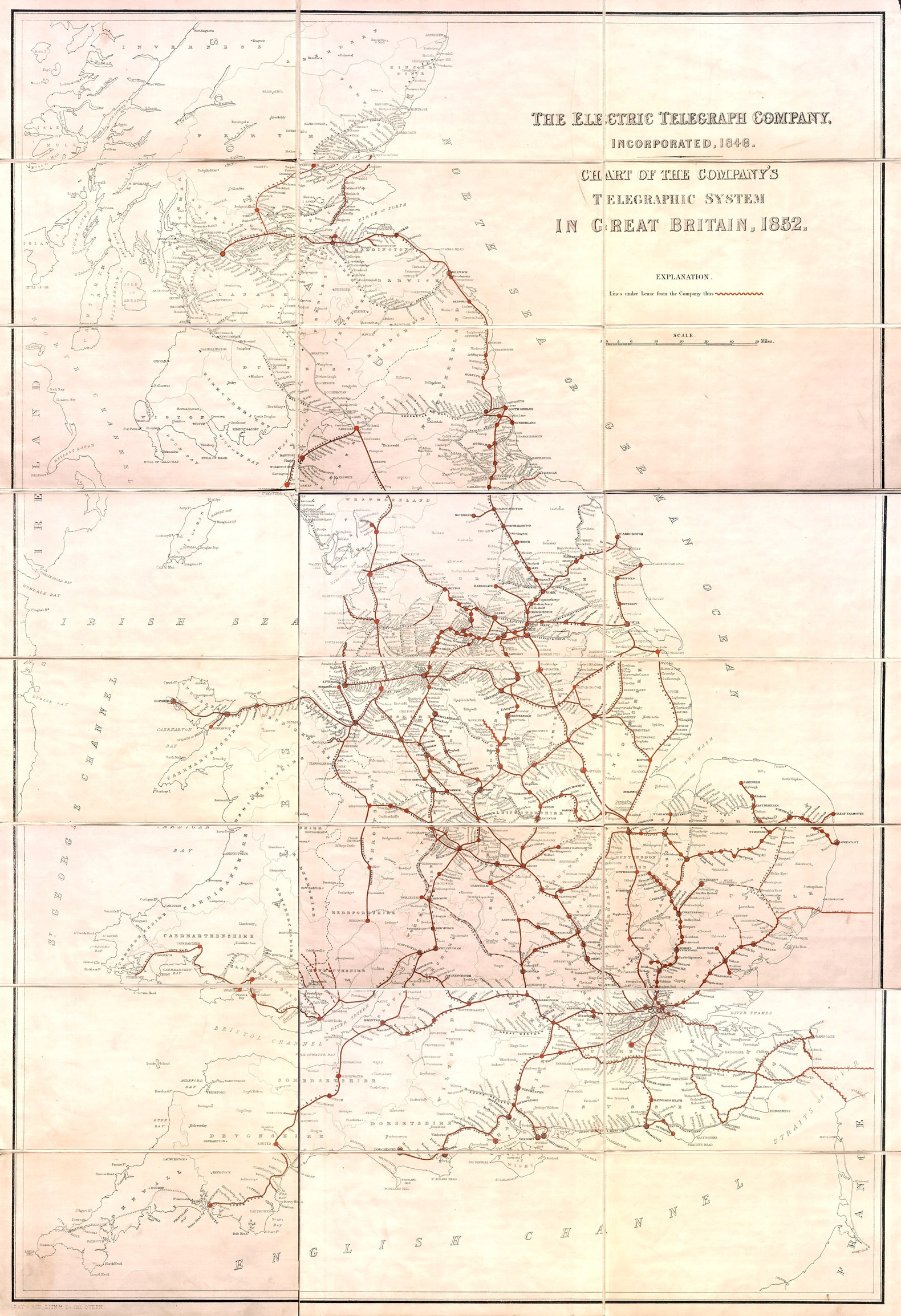
Click the thumbnail above for a greatly enlarged coloured version of
“The Electric Telegraph Company,
Chart of the Company’s Telegraphic System
in Great Britain, 1852”
published
by the Electric Telegraph Company and printed by Day &
Company, lithographers to the Queen, 17 Gate Street, Lincoln’s Inn
Fields, London
A large double-elephant size, 40 inches by
26¾ inches, paper map “dissected” and mounted on cloth for
convenient folding, and fitting into a protective slip case.
It was updated and reprinted regularly in the 1850s and 1860s,
versions dated 1852, 1853, 1859, 1860 (small) and 1866 are known
Courtesy of the Dibner Library of the History of Science and Technology, Smithsonian Institution Libraries
Europe 1856
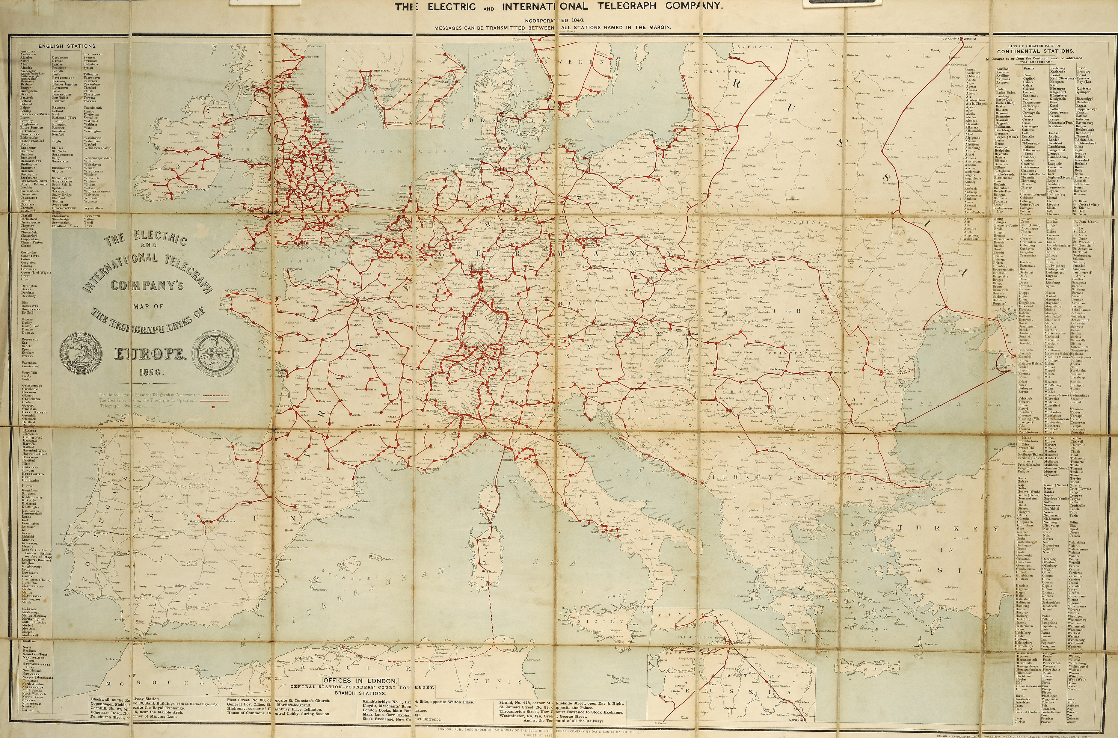
Click the thumbnail above for a greatly enlarged coloured version of
“The Electric & International Telegraph Company's
Map of the Telegraph Lines of Europe”
Published under the Authority of the Electric Telegraph Company by
Day & Son, Lithographers to the Queen
August 1, 1856
The map includes all of the several companies' telegraph circuits in
Great Britain and Ireland not just the Electric's own lines
It was lithographed in colour from stone to a size 30 inches by 36 inches,
on paper,“dissected” and mounted on cloth
See below for details of other versions, mostly printed only in black
(Click on Previous Page to resume)
Courtesy of Princeton University Library
Europe 1860
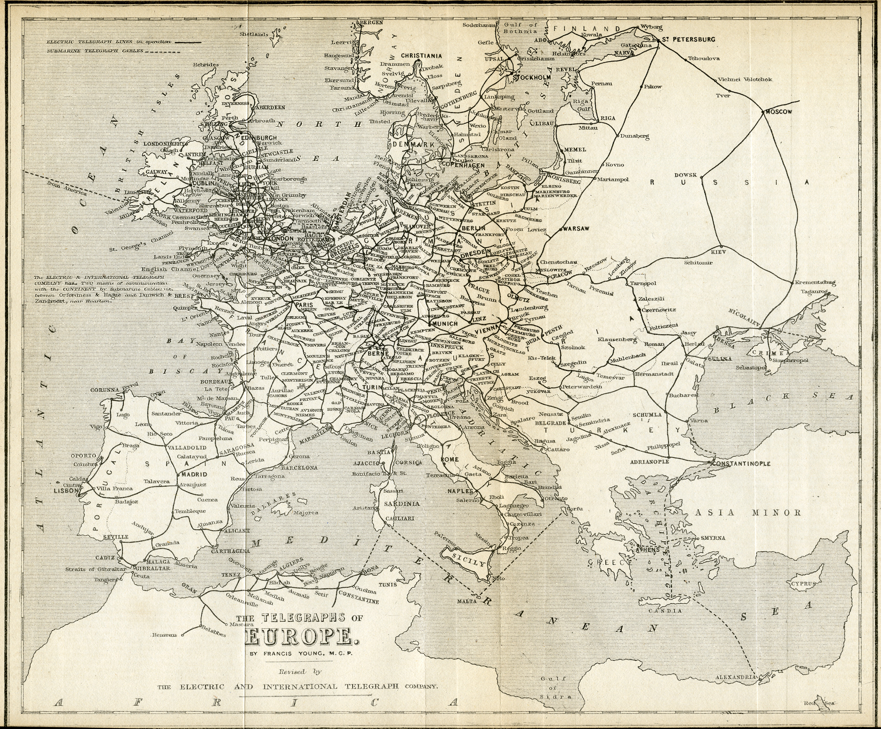
Click the thumbnail above for a greatly enlarged version of
“The Telegraphs of Europe”
published by the Electric & International Telegraph Company in 1860.
This map was a reprint to a double-elephant size, 40 inches by 26¾ inches,
of an earlier 30 inch by 36 inch version which accounts for the presence of
the original, short-lived Atlantic Cable of 1858. Versions dated
1854, 1855, 1856, 1859, 1861, 1863, 1865 are known
The map was compiled by Francis Young, a
professional teacher, and was engraved on steel by Lewis Becker by
his patent ‘Omnigraph’ process.
(Click on Previous Page to resume )
The East 1865
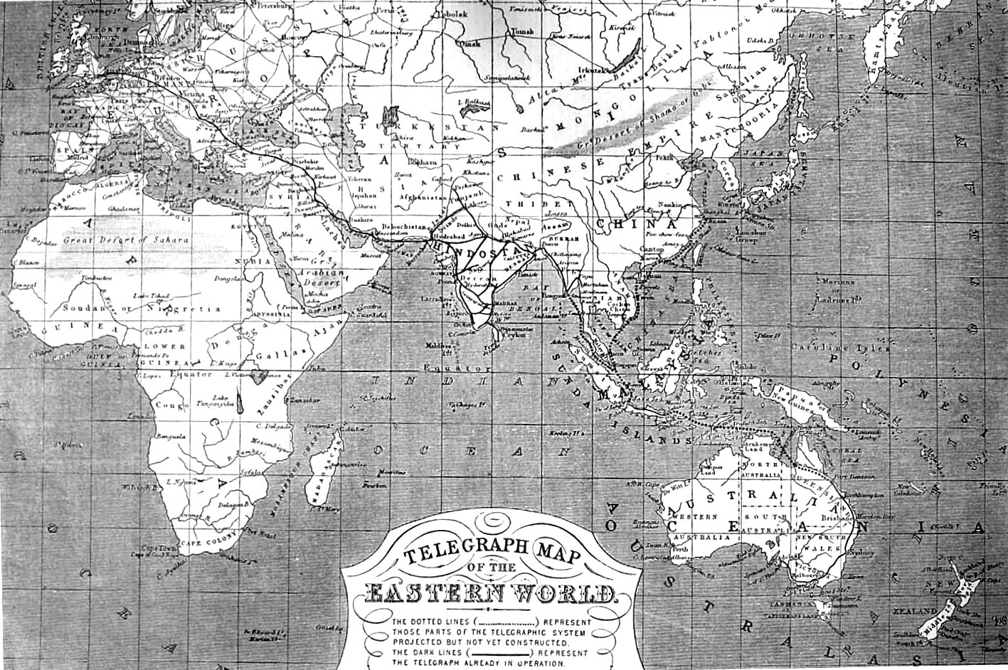
Click the thumbnail above for a greatly enlarged version of the
“Telegraph Map of the Eastern World”
published in the ‘Illustrated London News’ on July 8, 1865.
Of note is the limited mileage of electric telegraph outside of Europe
Drawn and Engraved by John Dower, FRGS, Pentonville, London
(Click on Previous Page to resume )
London 1866
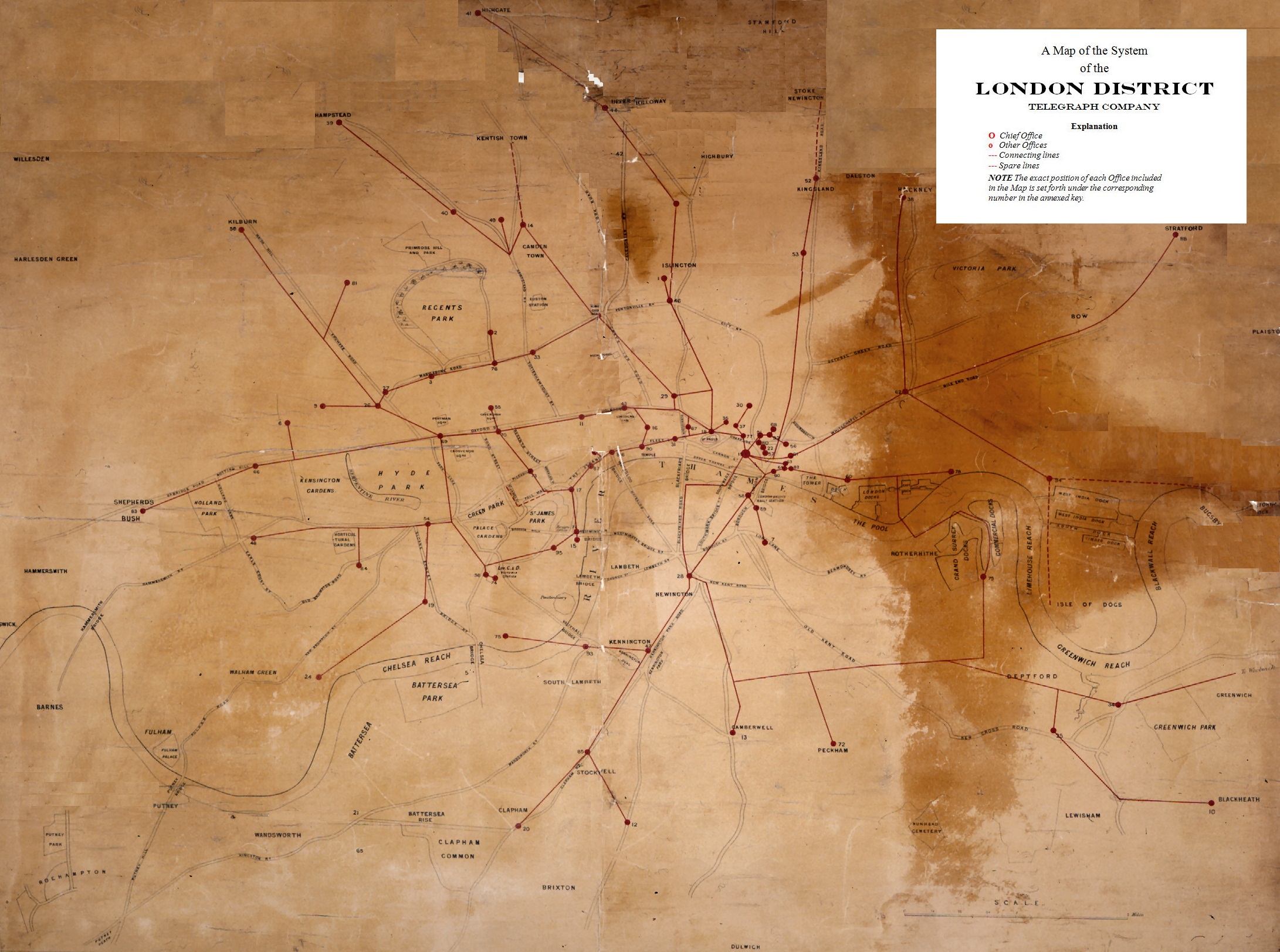
“A Map of the System of the London District Telegraph Company”
published by the Company, around 1866
The Company's telegraph offices are numbered alphabetically from
1, Agricultural Hall, Islington, to 95, Westminster, Houses of Parliament
(Click on Previous Page to resume )
This map has been digitally restored from a severely damaged original
Original image courtesy of the BT Archives
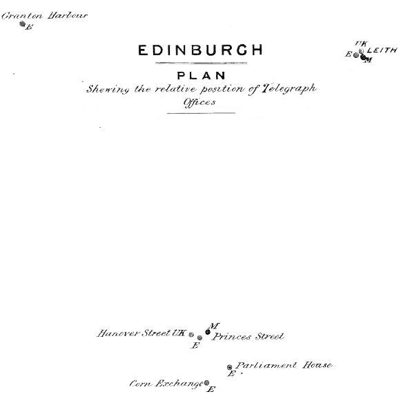
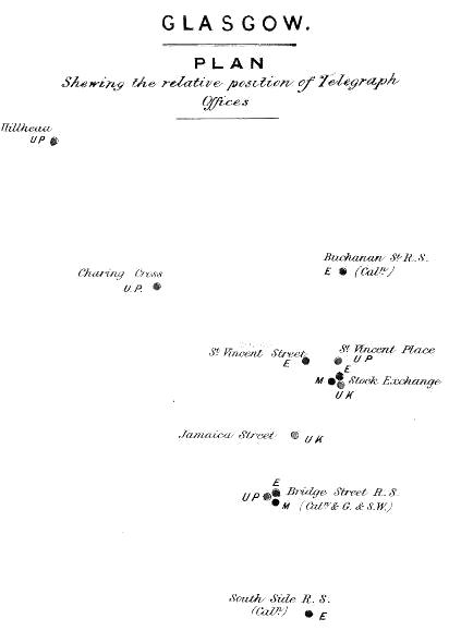
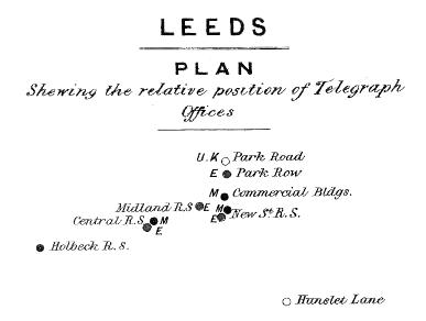
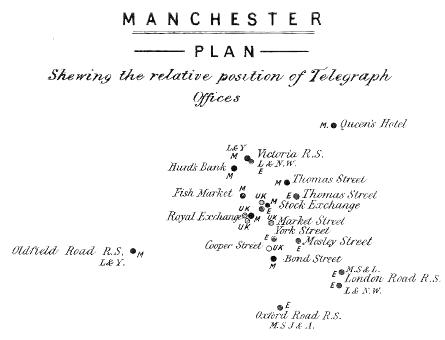
City Telegraphs 1868
Six diagrammatical
maps prepared by government surveyors showing the telegraph stations
in Birmingham, Edinburgh, Glasgow, Leeds, Liverpool and
Manchester just before the appropriation:


Telegraph, from the Greek “tele”, distant, and “graphos”, writing